P: +61 3 9867 6590
E: info@huntlycommon.com.au

The Project
A considered process for positive outcomes
The Bendigo Creek Reclamation and Rehabilitation Project is not your typical mining project.
It has a dual purpose – to deliver obvious economic benefit, but to also importantly deliver many shared benefits – ecological, environmental, community, cultural – through the area’s rehabilitation.
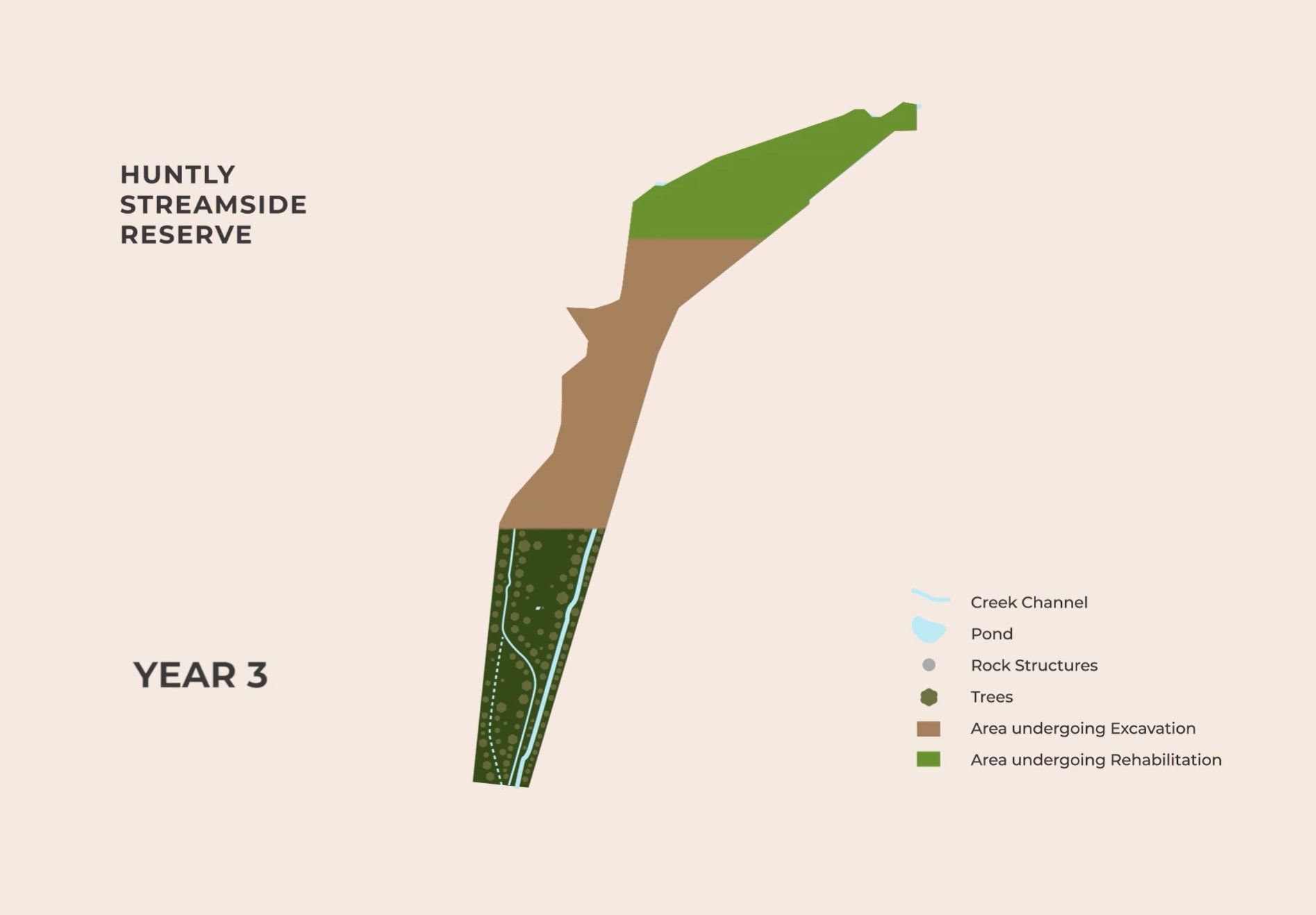
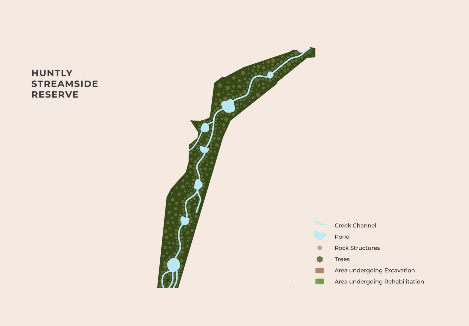
Image: Huntly Streamside Reserve Project Area
As stated by the City of Greater Bendigo’s Reimagining Bendigo Creek Plan, the present conditions of Bendigo Creek are directly connected with post-colonisation and the extensive mining activity that defined this period.
A heavily engineered drain has seen the unnatural straightening of the creek – effectively channelising it. Steep banks are highly erodible while water is conveyed quickly, precluding the formation of meanders, ponds or billabongs, and reducing the availability and diversity of native habitat. Exotic and invasive species of flora and fauna dominate the Reserve.
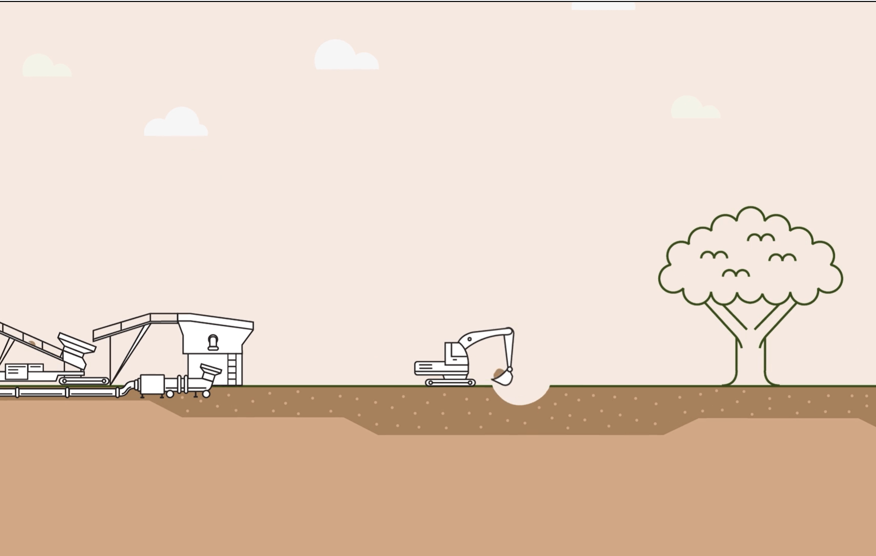
Huntly Common proposes to remove and treat 4 million tonnes of historical mining tailings that currently cover the surface of Huntly Streamside Reserve in a conventional process of tailings recovery.
Gold, mercury, and industrial sands will be recovered to fund operations and restore and rehabilitate the activity area over 4-6 years. Huntly Streamside Reserve will be restored to its original topography and returned to a more natural creek system, promoting a more valuable future ecology and increased biodiversity.
Mine tailings sludge will be progressively removed from the activity area using conventional excavators and pumped to nearby private land for processing. The reclaimed area will be immediately rehabilitated, one tennis court-sized panel at a time.
This rehabilitation project aligns with the Reimagining Bendigo Creek Plan, and is supported by Dja Dja Wurrung as the Traditional Landowners, realising their vision to “Restore the Upside-Down Country”.
Click here to read more on Rodney Carter’s vision for the Bendigo Creek (Rodney is The Dja Dja Wurrung Clans Aboriginal Corporation chief executive).
The steps to successful rehabilitation and restoration
Sludge
Removal
The sludge material within the Huntly Streamside Reserve is approximately ⅓ sand (>250 microns), ⅓ fine sand (106-250 microns), and ⅓ silt and clay (<106 microns).
This material will be reclaimed progressively across the reserve in a series of panels. A reclaim panel is expected to be 20m wide x 27m long. Reclamation will continue down to the natural ground surface (i.e., the ground surface that existed in 1850 prior to sludge deposition).
A maximum of three reclaim panels will be open at any one time. Vegetation that is growing directly in the natural surface (e.g., where the sludge layer has eroded) will remain.
Progressive Rehabilitation
Rehabilitation on the reclamation area will occur progressively in stages, which will be refined through ecological restoration studies during the EES process. The initial focus will be on dust prevention before moving to ecological plantings once soil is sufficiently stabilised. The stages are:
- Conditioning and irrigation of soil;
- Establishment of initial vegetation cover to minimise dust;
- Ecological planting to meet ecological objectives; and
- Ongoing maintenance to ensure satisfactory vegetation establishment.
The rehabilitation plan will be developed in conjunction with the Dja Dja Wurrung, City of Greater Bendigo, key agencies (Parks Victoria; Department of Environment, Land, Water and Planning; North Central Catchment Management Authority; Environment Protection Authority; Coliban Water; Goulburn Murray Water) and the Reimagining Bendigo Creek Steering Group. The project is expected to contribute to the Huntly precinct outcomes in the
Reimagining Bendigo Creek Plan (June 2020). This will be based on restoring and revegetating the Bendigo Creek and floodplain to its pre-European settlement state, to the extent practicable.
Creek
Restoration
Work on the watercourse will be sequenced so that flood flows through the reserve do not enter unrehabilitated reclamation areas during reclamation operations, and new waterways are established and stabilised before creek flows are diverted into them.
While a proposed waterway design will be developed through the EES process, the works will minimise disturbance to the natural ground surface once the sludge layer has been removed. It is possible that some areas may require deep ripping or other treatment to assist vegetation establishment due to soil compaction.
Other minor earthworks could be required to establish the desired creek environmental and cultural values (chain of ponds and riffles). The intent is to develop a watercourse design that is stable, non-erosive and requires minimal maintenance.

Click on image to enlarge
Conceptual drawing by Paul Wadell and commissioned by the Dja Dja Wurrung Clan Aboriginal Corporation.
The drawing brings attention to the possibilities of feasible designs that incorporate design elements for hydrological restoration, ecological rectification, cultural heritage preservation and public recreational enjoyment.
Bendigo Creek is one of the most modified creek systems, and most, if not nearly all, of Bendigo Creek doesn't align with its original watercourse. What we want to do is a challenge, and a challenge we're all up to, which is - let's allow the water to flow through the Bendigo Creek again that's now covered by soil and sludge
Rodney Carter
CEO
Dja Dja Wurrung Aboriginal Corporation
Level 1, 55 Whitehorse Road
Balwyn Victoria 3103
+61 3 9867 6590
info@huntlycommon.com.au